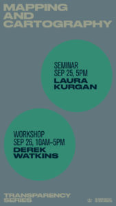
The world has always been a connected system, and it’s only becoming more so. As a form of journalism, maps contextualize the world by visually linking events to each other and to their geographic surroundings. If your story prompts questions like “What caused this to happen where it did?” or “Does this happen the same way in other places?”, a map can probably help illuminate things for your readers. Once the exclusive domain of specialized practitioners, new tools make it easier and easier to analyze spatial data and publish maps online. This series represents a kind of crash course in dealing with geographic data, designing elegant maps, and interpreting spatial data.
Join Laura Kurgan of the Spatial Information Design Lab at Columbia on Friday September 25 at 5pm in the Brown Institute space for a lecture on cirtical thinking about maps. On September 26 from 10a-5p, Derek Watkins will lead a hands-on workshop about journalistic uses of maps (this event required registration, which has now closed). It should be a great two days!
